Thursday, July 2, 2015

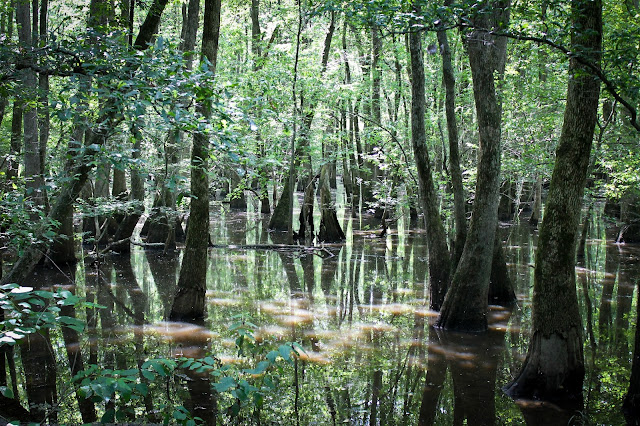
Section Eight Woods - Cache River Basin

"Cache River State Natural Area is situated in southernmost Illinois within a floodplain carved long ago by glacial floodwater of the Ohio River. When the Ohio River adopted its present course, it left the Cache River to meander across rich and vast wetlands. Among the outstanding natural features are massive cypress trees whose flared bases, called buttresses, exceed 40 feet circumference. Many are more than 1,000 years old, including one that has earned the title of state champion bald cypress because of its huge trunk girth, towering height and heavily branched canopy."  That tree can be viewed quite closely while walking the new boardwalk at Section Eight Woods.


The boardwalk, damaged by flooding in both 2008 and 2011, with as much as eight feet of excess water rising and breaking the wooden walk and leaving behind extensive damage.  In 2012, it was reopened by fundraising and volunteer work by the IDNR, Illinois Nature Preserves Commission, Friends of the Cache, and Southern Illinois Audubon Society last year was completed with financial support from those partners and the “Wetland Warriors” at Creal Springs School.  We had never been to Section Eight, despite having been to, and loved, Heron Pond, which is part of the same river basin.


Over the last 100 years, 230,000 acres, more than half of the former wetlands in the Cache watershed have been lost to land-clearing and drainage projects.  The Post Creek cut-off, completed in 1916, was especially damaging to the wetlands because it diverted the upper segment of the Cache River directly into the Ohio River and isolated 40 miles of the shallow lower channel.  After World War II, the forests of southern Illinois began to disappear at an alarming rate; followed by a 10 year period between the 1960s and the1970s, where thousands of acres of floodplain forest in the Cache watershed were cleared, drained, and converted to agriculture.  With the loss of habitat, increased
sedimentation, and large scale fish kills it became clear that the health of the Cache River Wetlands was in critical condition. As a result, local citizens organized the Citizens Committee to Save the Cache to protect what remained of the Cache River Wetlands. By 1990, this citizen-based conservation effort received a significant boost with the establishment of the Refuge and the Cache River Wetlands Joint Venture. Today, through cooperative conservation, the tide of wetland
destruction is being reversed.  There's a whole lot more to the Basin than the few places we have been, which leaves lots of room for more adventures down South.


We were taking one of the Harley's down to Paducah for a cruise when Kevin unexpectedly pulled over at the entrance to Section Eight.  Unlike Heron Pond, which is far from the beaten path, Section Eight is right off the main road.  If you aren't watching for it though, you may miss it.  The parking area is small, and it's easier to see going one way over the other.


The boardwalk is nice, it's clean and wide, although we actually only met one other group of three, who entered as we were leaving.  It's pretty, and it's peaceful.  Not nearly as long a boardwalk as Heron Pond, you can meander in and out in 15 minutes or so, and that's taking your time.  But if your out there for bird or critter watching, or nature photography, you could conceivably spend some quality time uninterrupted.


How to get there:

Follow 37, Section Eight is just past Cypress Grove.
N 37° 18.195 W 089° 01.293

Friday, April 10, 2015

Hawk's Cave Trail

Hawk's Cave Trail is in Fern Clyffe State Park, in Goreville.  A place I've been many times, but had never taken this other trail.  In fact, there are several trails here I still need to explore.


Hawk's Cave is a short trail, probably a little less than a mile loop, about the same as the waterfall trail.  When you park in the lot, instead of hiking straight onto the waterfall trail, veer left and go across the stepping stones.  That trail will split into three, Hawk's Cave trail is on the far left.


The trail itself will Y a little ways into it, but it's a loop, you can't get lost.  Your only decision is really if you want to go uphill before or after exploring the cave (haha.  We chose before in which case you go right.)


You won't see the cave coming until your nearly in it.  That's the beauty of it.  This massive cave site so perfectly in the rock face that your just walking along minding your own business wondering when this cave will appear and Bam! Your in it.  It's massive.  It doesn't go back too terribly far, but it is move cave than overhang.  There's a lot of big stones that have fallen laying around that you can climb on and have fun with, just be careful, play at your own risk.  I don't have the slightest clue where the nearest hospital is or how long it would take them to get to you.


There's a smaller cave as you leave Hawk's Cave, I could see it from the trail (which is really pretty at that point) but we didn't go back to it, simply because I was doing a photo shoot at the time and light is never on our side.


Walking back down you'll cross a cute little footbridge crossing a stream.  The kids loved it, and had it been a little warmer, I'm sure would have been in it.


You go back down the hill you walked up, then meet back up at the main trail.  You should still have plenty of energy to go and see the waterfall. :)

Take rt 37 to Goreville, and follow it through town.  Just outside of town you'll see the sign for Fern Clyffe.  If you want more to see, Tunnel Hill State Trail isn't far!


Monday, April 6, 2015

The Marvel Theatre

If you grew up in Carlinville, a good part of your childhood was probably spent in the Marvel Theatre.


The Marvel first opened August 26, 1920  by the Paul family as a live theater.   Unfortunately, it promptly burned down on December 18, 1926.  Fortunately for Carlinville, it was re-built and opened again January 19, 1928.  During the 1940s, Marvel was operated by the Frisina Amusement Company.  The second theater came in 1977, with 156 seats in the balcony, and 300 seats on the main floor.  The marquee that is still on the front of the building is from the 60s.  When I was a kid, Norman Paul owned and operated the Marvel, the son of the original owners.  It was family owned for three generations.

I remember Norman being being behind the concession stand or taking tickets.  As a Carlinville kid, I went to the movies all the time.  My first 'date' was at the Marvel, a James Bond flick in the upper balcony, if I remember correctly, with my date's parents two rows behind us.  The best years were when there was an old time ice cream parlor across the street, where we could stuff ourselves on sugar after catching a show.  My son, now ten, had been to the Marvel only once or twice, as we no longer live in Carlinville, but even his first trip to the movies was there, Monsters VS Aliens, if I remember correctly, a family affair.

Norman passed away in 2011, and his wife Del passed in 2014.

  The digital age was almost the undoing of the Marvel.  Celluloid films were becoming a thing of thr past, with digital movies replacing the old reels.  These were cheaper for the movie companies to produce, ship, and store.  Many classic movies have been digitized, with all their old celluloid reels destroyed to make room.  While digital movies are great for moviegoers (think better, brighter pictures and state of the art sound) it's a big hit for the theaters, with a price tag of $50,000 per auditorium.  With prices for tickets awesomely low, the Marvel couldn't compete or convert, and eventually closed.   In 2011, the Marvel was bought and remodeled by Steve Dougherty, who also owned West Side Cinema in Litchfield.  Along with management changes, Dougherty put in new carpet and flooring, new restrooms and exits, a new concession stand, and a state of the art conversion to digital projection, making the two screens 3D capable.

Unfortunately, it closed again February 27, 2014.  Time has yet to tell if someone new will swoop in and rescue our ninety-five year old theatre.  I would love to see it happen, but I'm afraid that in order to cover all the costs or renovation and upgrades, ticket prices would have to be raised enough that people would rather go to the big theaters in Springfield, or pay a few dollars a person at the Drive In in Litchfield.  I'm not sure that the Marvel will ever again be functional, but I would dearly love it to be so.

Friday, March 20, 2015

Tunnel Hill State Trail

The Tunnel Hill State Trail has had many names; the Vincennes and Cairo Railroad, the Wabash, the St. Louis, Pacific, New York Central, Penn Central, Conrail,  the Cleveland, Cincinnati, Chicago, St. Louis line (also known as the CCC & St. Louis or Big Four) the Southern Line, and finally Norfolk Southern Railroad.  The rumble of freight and coal cars reverberated through the narrow tunnels instead of footsteps.  Passengers in Pullman cars saw Southern Illinois' scenic landmarks, instead of bikers and dog walkers.


In 1991, Norfolk Southern gave the State of Illinois the railroad right-of-way between Harrisburg and Karnak, where it had abandoned operations. The Department of Natural Resources has worked to develop the railroad ballast as a trail for hikers, joggers and cyclists, surfacing the trail with crushed limestone and gravel, installing privy toilets and providing drinking water. The first segments of Tunnel Hill State Trail opened in 1998. The trail was completed in the fall of 2001.

I had the pleasure of finally getting to walk a small part of the trail while doing an engagement photo shoot for my childhood (best) friend.  I've been meaning to walk the trail for years, but it's quite the drive for us to get there, and the only bikes we own have motors, so it seems kind of silly to drive all the way over for a mile or so walk.  I was thrilled for it that day, though.


I believe there are several entrances to the trail, but we came in right by the tunnel.  For more than 50 years after the railroad was built, the tunnel was longer than 800 feet, but when a portion of the tunnel collapsed in 1929, the landmark was shortened by 300 feet. Now 543-feet long, it is the only tunnel on the trail. The tunnel is located 1/4 mile south of Tunnel Hill on the trail toward Vienna.  This is on the trail's highest point, exactly midway on the trail, 680 feet above sea level.  Apparently the slate filled hill was enough of a nuisance for the railroad that it was easier to tunnel through it rather than go around it.


Unfortunately I did not get to go any further than the tunnel, but from the DNR website I learned there are other unique features to the 45 mile long trail: "The 23 picturesque trestles along the completed sections of Tunnel Hill State Trail feature decking and side rails, which entice trail users to stop. The trestles range in length from 34 to 450 feet. The longest in Breeden Trestle, which is also the highest at 90 feet. It is located 2 1/2 miles south of Tunnel Hill. In addition to the large communities found along the 45 miles, there also are hamlets along the trail, including Bloomfield, Sanburn and Ledford. In addition, there are a handful of locations that could be described as ghost towns - Forman, Bender, Rago, Parker City and New Castle. All serve as landmarks to trail users. Interpretive signs along the length of the trail point out old coal mines and a sandstone quarry."

We took our pictures around the tunnel, and just a little beyond it.  It was after sunset and getting close to dark, as well as being cold (yet still unseasonably warm) since it was December.  We passed several people while on the trail, most of which had dogs happily trotting along with them.  On the way back to the parking lot, I was looking up and taking everything in, and we passed right underneath a barred owl.  I LOVE owls (and birds of prey in general) and hurried back to the car for my good camera lens.  Lucky for me, he was still there when I walked back, despite the fact a woman and several dogs had also passed beneath him.  DNR's website says many wild animals can be seen along the trail at various points during the year.


The trail can be biked in one day, and hiked in two or three, but be advised there is no camping facilities on the trail itself.  There are campgrounds nearby, but you would need to use the buddy system as far as vehicles are concerned, plotting out your stops each day and dropping a vehicle at each end of your hike.  Shawnee National Forest has three campgrounds within 10 miles of the trail: Lake of Eqypt, north of the community of Tunnel Hill; and Teal Pond and Bell Smith Springs, both southeast of New Burnside. A fourth, Lake Glendale , is about 15 miles east of Vienna. Also located in the same vicinity as Lake Glendale is Dixon Springs State Park. Two other state park campgrounds are about 10 miles from the trail: Ferne Clyffe, west of the community of Tunnel Hill; and Saline County Conservation Area, southeast of Harrisburg.  Horses are not allowed on the trail.


How to get there:

Highway 146 East
P.O. Box 671
Vienna, IL 62995
618.658.2168

Follow I-57 S and I-24 E to IL-146 W in Vienna.  (Take exit 16 from I-24)
Turn R onto IL-146 W.
You will see the trail's parking lot on the left.